
The dance of the sun across our sky has fascinated humans for eons. Its daily trek from the horizon to its zenith, only to set again, is a marvel that most of us take for granted. But for astronomers, environmentalists, architects, and many other professionals, understanding the position of the sun, specifically its altitude, is crucial.
Enter the concept of the Solar Elevation Angle. Here, we will talk about this topic, offering a guide on how to calculate the sun’s altitude, no matter your background.
The Basics
Understanding the intricate ballet of celestial bodies starts with grasping a few fundamental concepts. As an introductory note, let’s demystify what the solar elevation angle is and why it matters.
Definition and Importance
The Solar Elevation Angle (SEA) is a measure of the sun’s position in the sky. Specifically, it denotes how high the sun is from the horizon, expressed in degrees. If the sun is directly overhead, the angle is 90°, while at sunrise and sunset, this angle is 0°.
- Relevance in Astronomy: For astronomers, the angle helps in determining the best time to view specific celestial bodies.
- Architectural Significance: Architects use this angle to design buildings that maximize sunlight during winter and minimize heat during summer.
- Environmental Implications: By understanding the solar elevation angle, environmentalists can assess the amount of solar radiation reaching a particular location, aiding in solar panel installations.
Factors Influencing SEA
Several factors determine the exact solar elevation angle at any given point:
- Latitude: Generally, places closer to the equator experience higher SEAs.
- Time of Year: During equinoxes, most places on Earth experience roughly equal day and night. However, during solstices, the variance in SEA is stark, especially in higher latitudes.
- Time of Day: As the sun progresses from sunrise to sunset, the SEA varies, reaching its peak at solar noon.
The Calculations
Now, let’s delve deeper into the mathematical aspect. Don’t fret; we’ll break this down step by step, making it palatable for even the math-averse.
The Basic Formula

At the core of calculating SEA is the following equation: SEA = 90° – Zenith Angle where the zenith angle represents the angle between the point directly above you (the zenith) and the sun.
Decoding the Zenith Angle
This might sound complicated, but with a few pieces of data and a touch of trigonometry, it’s accessible:
- Declination (δ): This is the angle between the rays of the sun and the plane of the Earth’s equator. It varies throughout the year due to the tilt of Earth’s axis.
- Hour Angle (H): It represents the time since solar noon, measured in degrees. Every hour equates to 15°.
- Latitude (φ): Your geographical north-south position on the Earth.
With these in hand, the zenith angle (Z) can be found using: cos(Z) = sin(δ)sin(φ) + cos(δ)cos(φ)cos(H) Once you have Z, plug it into the initial formula, and voilà – you have the Solar Elevation Angle!
Applications in Real Life
![]()
Knowing the theory is half the battle. Let’s discuss how this information is applied in various fields, transforming theoretical numbers into practical solutions.
In Architectural Design
Architects, particularly those focusing on sustainable design, often use the SEA:
- Sun Path Diagrams: These are visual representations of the sun’s movement across the sky. They assist architects in positioning buildings and windows to optimize natural light.
- Temperature Regulation: By understanding the angle of the sun during different seasons, architects can design overhangs or shades to block or allow sunlight, aiding in temperature regulation.
For Solar Panel Installation
Solar panels need optimal sunlight. Thus, knowing the sun’s trajectory is paramount:
- Optimal Tilt Angle: This is often adjusted seasonally to ensure maximum solar absorption. The angle is closely tied to the SEA, and by understanding the latter, one can optimize the former.
- Maximizing Efficiency: Panels can be adjusted to track the sun’s movement, ensuring that they are always facing the sun at the optimal angle.
DIY: Track the Sun’s Movement

For those inspired to understand the sun’s movement in their location, here’s a hands-on guide:
Required Tools
- A flat horizontal surface (e.g., a table)
- A vertical stick or rod
- A protractor
- A watch
Steps
- Setup: Place the stick on the table so it stands vertically. Ensure the setup is in an open space with a clear view of the sky.
- Shadow Tracking: Every hour, mark the tip of the shadow cast by the stick.
- Measure Angles: Using the protractor, measure the angle between the shadow and the base of the stick. This gives a rough estimation of the SEA.
- Record & Analyze: Over several days, you’ll notice patterns – the sun reaches its highest point roughly at solar noon and the angles vary with seasons.
While this method isn’t as precise as mathematical calculations, it offers a tangible and visual representation of the sun’s movement, making the concept of SEA more relatable.
Tools and Modern Innovations

Technology is continually evolving, and with it, our understanding and accessibility to concepts such as the Solar Elevation Angle. Let’s shine a light on some of the tools and innovations that have made SEA calculation more user-friendly and accurate.
Digital Applications & Software
There’s an app for nearly everything these days, and SEA is no exception:
- Sun Surveyor: This app visualizes the sun’s path, showing its rise and set times, the magic hour (a period favored by photographers), and more.
- Solar Noon Apps: Designed for solar enthusiasts, these apps can predict the exact time of solar noon for your location, helping in determining the highest SEA for the day.
- Building CAD Software: Modern architectural software like AutoCAD and Revit have built-in tools that can simulate the sun’s path, aiding architects in real-time design decisions.
Drones & Advanced Sensors
For large-scale applications, especially in agriculture and solar farms:
- Drone Surveillance: Drones equipped with sunlight sensors can provide real-time data on sun exposure over vast fields, allowing farmers to understand and leverage the sun’s movement for better crop yield.
- Solar Sensors: These devices, when placed in potential solar panel installation sites, can record SEA data over days or months, ensuring the location is optimal for solar energy harvesting.
The Impact on Culture and Art
Interestingly, our understanding of the sun’s movement has significantly impacted art and culture. It’s not just about the numbers; it’s about how those numbers shape our experience of the world.
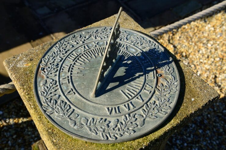
Sundials: The Ancient Solar Clocks
Before the advent of modern clocks, sundials were used to tell time:
- History: Ancient civilizations, including the Egyptians and Romans, utilized the changing position of the sun and its resultant shadows to develop timekeeping tools.
- Cultural Significance: Sundials were often considered symbols of knowledge and enlightenment, and they adorned public squares and educational institutions.
Photography and Film
The golden hour, which is closely tied to SEA, is a favorite among photographers and filmmakers:
- Chasing the Golden Light: This period, shortly after sunrise and just before sunset, offers soft, warm, and diffused light. Knowing the SEA helps photographers predict the exact timing of the golden hour.
- Films and Music Videos: Many iconic shots in films and music videos are captured during this magical time. Knowledge of the sun’s position aids in planning the shoot schedules.
FAQs
How does the Solar Elevation Angle vary?
The elevation angle changes throughout the day. It is 0° at sunrise, reaches its maximum at solar noon, and returns to 0° at sunset. The angle also varies based on the latitude of a location and the day of the year.
What is the significance of the maximum elevation angle in photovoltaic systems?
The maximum elevation angle is crucial in the design of photovoltaic systems. It represents the highest point the sun reaches in the sky at a particular time of year, especially at solar noon. This angle is influenced by the latitude and declination angle.
What happens when the elevation angle at solar noon is greater than 90°?
If the calculated elevation angle exceeds 90°, you subtract the result from 180°. This indicates that the sun at solar noon is coming from the south, which is typical in the northern hemisphere.
What is the zenith angle?
The zenith angle is the angle between the sun and the vertical. It is similar to the elevation angle but is measured from the vertical rather than the horizontal. The zenith angle is calculated as 90° minus the elevation angle.
How do you calculate the times of sunrise and sunset?
To determine the sunrise and sunset times, the elevation is set to zero, and the elevation equation is rearranged. The formulas involve the latitude, declination angle, and a time correction factor.
What happens to the elevation angle at the Tropic of Cancer during the summer solstice?
At the Tropic of Cancer on the summer solstice, the sun is directly overhead, and the elevation angle is 90°. In summer, at latitudes between the equator and the Tropic of Cancer, the elevation angle at solar noon can exceed 90°, indicating that sunlight is coming from the north.
Why is understanding the elevation angle crucial for PV system design?
While the maximum elevation angle is essential for basic PV system design, a more accurate PV system simulation requires knowledge of how the elevation angle changes throughout the day. This understanding helps optimize the positioning and efficiency of solar panels.
Final Words
The Solar Elevation Angle isn’t just a fancy term relegated to textbooks. It’s a dynamic concept with real-world implications. Whether you’re planning to install solar panels, design a home, or simply satiate your curiosity, understanding the sun’s trajectory is enlightening – both literally and figuratively. Armed with this knowledge, you’re now attuned to the subtle dance of our brightest star, a performance playing out daily right above us.